 WARNING: Cancer and Reproductive Harm-
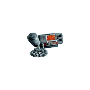
 PLOT YOUR PARADISE – with the best, most up-to-date Garmin Navionics Vision+™ premium marine cartography on your compatible Garmin chartplotter. For offshore or inland waters, get premier-grade chart features, including detail-rich integrated mapping, high-resolution relief shading, 3D views, satellite imagery, advanced Auto Guidance+™ technology and access to daily updates via the ActiveCaptain® app. Card type SD/MSD.For Garmin Chartplotters Only. Some features require subscription. See Navionics website for compatibility, coverage details & full list of features.
Description
Additional information
| Weight | 0.13 lbs |
|---|---|
| Dimensions | 5.8 × 4.1 × 0.9 in |
| Territory | U.S. East, U.S. North, U.S. South, U.S. West |
Reviews
There are no reviews yet.